bridge
Story Sunday: Can Opener Bridge
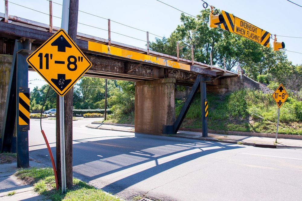
Photo Author: Mark Clifton
Click for a larger view.
At 11 foot 8 inches [sic], the Norfolk Southern-Gregson Street Overpass, located in Durham, [NC] […], is a bit too short. The federal government recommends that bridges on public roads should have a clearance of at least 14 feet [but], when this railroad trestle was built in the 1940s, there were no standards for minimum clearance. As a result, trucks would frequently hit the bridge and get its roof scrapped [sic] off.
Durhan resident Jürgen Henn has been witnessing these crashes for years from across the street where he worked. Wishing to share these hilarious mishaps with the rest of the world, Henn set up a video camera in April 2008 and began recording them for his ever popular website 11foot8.com. By the end of 2015, more than one hundred trucks had their tops violently ripped off. These scalping videos, which are also available on his YouTube Channel, have racked up millions of views bringing this particular bridge, nicknamed “the can opener”, a fair amount of international fame.
As Jürgen Henn explains in his website [sic], the bridge cannot be raised because doing so would require the tracks to be raised for several miles to adjust the incline. North Carolina Railroad doesn’t want to pay for the enormous expense it would entail. The bridge cannot be lowered either because there is a major sewer line running only four feet under the street.
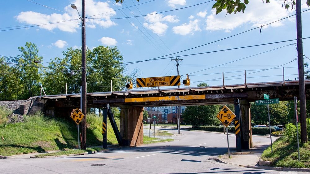
Photo Author: Mark Clifton
Click for a larger view.
Instead, the city authorities installed an alert system that detects when an over-height truck tries to pass under and flashes yellow warning lights several feet ahead of the bridge. [However], many drivers either do not pay attention or fail to heed the warning and crash into the bridge. The railroad department, who owns the bridge, installed a heavy steel crash beam in front of the bridge that takes most of the impact, protecting the actual structure of the train trestle. This crash beam is hit so often that it had to be replaced at least once.
As far as both parties are concerned, the city of Durham and North Carolina Railroad, adequate steps have been taken to solve the problem. The railroad authorities’ concern is with the bridge and the rails above, not the trucks, [hence], the beam. The city, on the other hand, has posted prominent “low clearance” signs from [three] blocks away, leading up to the trestle, over and above the automatic warning system that is triggered by vehicles that are too tall. Apparently, these measures are not enough to prevent accidents. On average there is one crash every month.
When Henn interviewed a few drivers as they deflated their tires to lower their vehicles enough to free them, some told him that they didn’t know their trucks’ heights, while others insisted they didn’t see the signs. Durham officials are now trying out a new tactic. A few months ago, they installed a traffic signal at the intersection before the bridge and hooked up the height sensor to it. When an over-height truck approaches the intersection, the light turns red and stays red for a long time. The light eventually turns green but, the city hopes that the long delay will give the drivers enough time to realize their truck will not fit under the bridge. Unfortunately for the drivers, and to the delight of the rest, the bridge continues to shave the tops of over-height vehicles.
The Infamous Can Opener Bridge
Amusing Planet
Kaushik Patowary
December 17, 2016
I can attest to this bridge, personally. I lived in Durham for two years in the middle 90s. Why those folks don’t turn off onto Peabody Street or Pettigrew Street, coming from the other side, I don’t know. They just plow right under it. It is right behind Brightleaf Square. ~Vic
Jürgen Henn’s Website
Henn’s YouTube Channel
Additional:
♦ 11 Feet, 8 Inches… (99% Invisible/Kurt Kohlstedt/08-29-2016)
♦ Durham’s Bridge of Death Will Decapitate Any Tall Truck (Bloomberg/John Metcalfe/10-25-2012)
♦ Trucks Have Hit This Low Bridge More Than 100 Times… (Vox/Timothy B. Lee/01-06-2016)
♦ A Little Off The Top… (Indy Week/Danny Hooley/01-06-2016)
♦ Norfolk Southern–Gregson Street Overpass (Wikipedia)
Compilation of Crashes
Hunter’s Blue Moon Halloween 2020
I did a complete write-up in 2018 on the Hunter’s Moon so, I won’t repeat it, here. That being said, this is a Blue Moon as October’s first full moon fell on…well…the first.
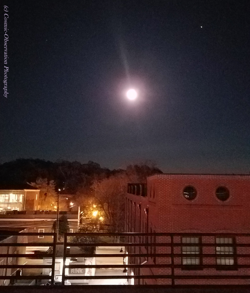
10-30-2020
Click for a larger view
From Moon Giant:
Humans through the ages have always found autumn’s full moons to be creepy and not without good reason. [T]his year, the moon will be extra exciting. The month starts with the Harvest Moon on October 1st and a second Blue Moon on Halloween, October 31st. The Harvest Moon is the Full Moon that falls closest to the Autumnal Equinox on September 22nd. In most years, the September Full Moon lands closest but, this is one of the rare years that the October Full Moon falls very early in the month and closest to the Equinox. This makes the first Full Moon the Harvest Moon and, the second, the Full Hunter’s Moon.

Click for a larger view
More from Moon Giant:
The modern day definition of a Blue Moon is when there are 2 Full Moons in one month. A Full Moon occurs roughly every 29.5 days and, on the rare occasion when the Full Moon falls at the very beginning of a month, there is a good chance a Blue Moon will occur at the end of the month. Depending on the exact time of the Blue Moon it is possible that some places in the world don’t technically have a Blue Moon. The modern definition […] was derived from an earlier idea of what a Blue Moon was. This earlier definition says a Blue Moon is when there are [four] Full Moons in a season rather than the usual [three]. The Blue moon is the 3rd Full Moon out of the 4. This definition gets a bit complicated and its origins are murky. One school of thought has to do with the naming of the Full Moons. Many cultures named the Full Moons each month to reflect the times for planting, harvesting or seasonal conditions. When an extra Full Moon was thrown in it was referred to as a Blue Moon to keep the Full Moon names constant throughout the year. The idea of a Blue Moon being the extra full Moon in a season (or when there were 13 in a year) was widely used in 19th, and early 20th [century], Farmers Almanacs and the more modern version seems to have come from an article written in the 1930s that misinterpreted the Farmers Almanac definition. The article was titled “Once in a Blue Moon” and from that point on, the term became part of the popular culture.

Click for a larger view
From Time and Date:
Why is it called a Blue Moon? The historical origins of the term and its two definitions are shrouded in a bit of mystery and, by many accounts, an interpretation error. Some believe that the term “blue moon”, meaning something rare, may have originated from when smoke and ashes after a volcanic eruption turned the Moon blue. Others trace the term’s origin to over 400 years ago. [F]olklorist Philip Hiscock has suggested that invoking the Blue Moon once meant that something was absurd and would never happen. This Halloween Blue Moon […] is also a Micro Full Moon.

10-31-2020
Click for a larger view.
Click for a larger view
100% illumination occurred at 10:49am EDT. ~Vic
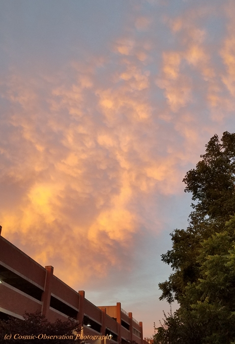
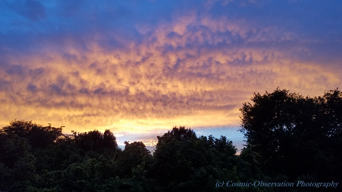
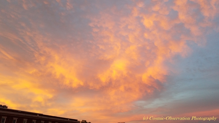
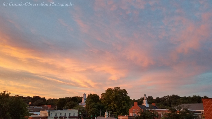
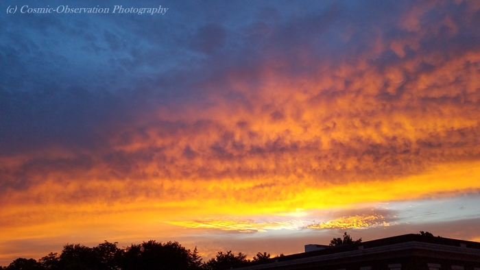
Foto Friday: Sky Gazing 5.0
These are companion shots to my POTD: Sunset post, as well as previous Sky Gazing posts. This town can have some of the most glorious sunsets and quirky cloud formations. ~Vic
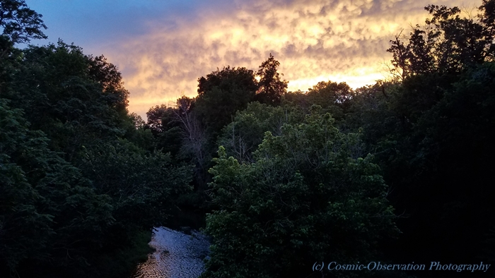
06-24-2020
Snapshots Sunday: Alamance Battleground 2.0
Two months ago, on December 7, 2019, I visited Alamance Battleground with my buddy Ray. I posted the first batch of pictures on December 8, intending to post the rest on December 14. For obvious reasons, that didn’t happen so, here are the rest.
All photos are my personal collection. © ~Vic

Originally located at Guilford Courthouse Military Park
Moved in 1962, “on indefinite loan.”


It is claimed that the battle was the first of the Revolutionary War.
It was actually the last battle of the War of Regulation,
which lead to the Revolutionary War.

James Hunter
General of the Regulators

North Carolina Timeline
1774 North Carolina Provincial Congress
The Mecklenburg Declaration 1775
Battle of Moore’s Creek Bridge 1776
North Carolina is the first to call for independence
with the Halifax Resolves 1776

Six were executed.
“Our blood will be as good seed in good ground,
that will soon produce one hundred fold.”
James Pugh June 19, 1771


Dates reflect the Mecklenburg Declaration of Independence (disputed but,
possibly Mecklenburg Resolves) and
the Halifax Resolves.
Shutterbug Saturday: Frog Strangler 2.0
We continue to have stormy, rainy weather and the temperature has dropped, considerably. We traded floods for tornadoes, yesterday. I learned, today, that two small farms south of town were damaged. I have a healthy respect for Mother Nature. ~Vic
See Part I

This helped flood my neighbor's backyard.
04-13-2019


The town closed it for a couple of days.
I saw a juvenile garter snake making its way back across the walk when I was out on the third day.


Shutterbug Saturday: Loving Fall
The leaves, the leaves are falling…
A pathway in our local Riverwalk.

Local pink Mums.

One of many resting benches along the Riverwalk.

Lovely lavender Mums.

One of several Riverwalk bridges.

I spent my day running errands, enjoying walking the Riverwalk and getting my beloved Mum collection. When I walked out of the house at Noon, the temperature was 72°. I love this time of year. I just wish the mosquitoes would go away, already. ~Victoria
